
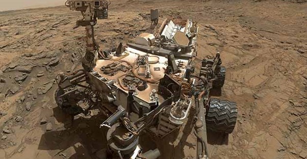

30 Stunning Pictures of Mars, Taken by Curiosity and The Late Opportunity Rover
30 Stunning Pictures of Mars, Taken by Curiosity and The Late Opportunity Rover. NASA’s Opportunity rover’s life was short-lived; it launched in July 2003, but a dust storm swept across Mars in June 2018, and the rover hasn’t taken pictures of Mars’ surface since then. But luckily for us, it took quite a few stunning pictures before (and even during) its final few days on Mars. So we have those iconic shots, plus Opportunity rover’s final photos, for you to look through. And because Opportunity’s time on Mars was just so short, we’ve also included plenty of shots taken by NASA’s Curiosity rover—which launched in November 2011 and is still going strong.
Whether you want to learn more about Mars geography (like Mount Sharp, Point Lake, Garden City, etc.), or you’re just curious and want to see what Mars looks like up close and personal, take a look through the 30 photos in our gallery and you’ll definitely find what you are looking for! The Curiosity rover even took a couple of fun selfies for us!
Here are 30 Stunning Pictures of Mars, Taken by Curiosity and The Late Opporutnity Rover (all taken from NASA’s official website). Click through to see the entire gallery!
Opportunity's The Last Message
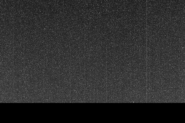
The late Mars Opportunity rover’s last photo was taken on June 10, 2018. Per NASA.gov, “Opportunity took this image with the left eye of the Pancam, with its solar filter pointed at the Sun. But since the dust storm blotted out the Sun, the image is dark. The white speckles are noise from the camera.”
Curiosity Rover Left Its Mark
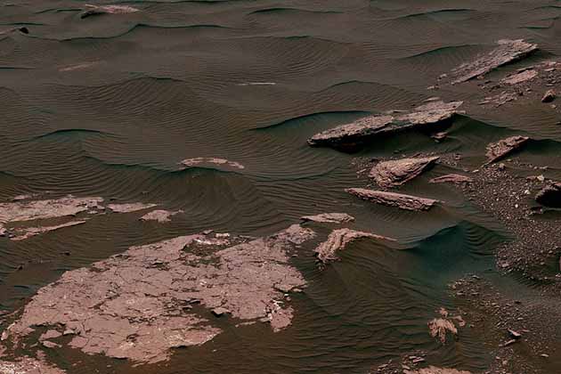
Here, you can see two scales of ripples left on Mars by the Curiosity Rover.
Garden City
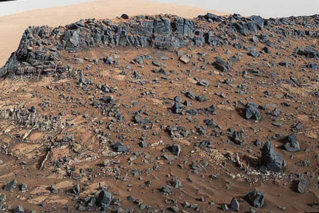
This lower side of Mount Sharp was taken by Mars Curiosity rover on March 27, 2015.
Leaving Tribulation Behind
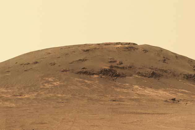
This shot, which looks back at the southern end of Cape Tribulation from about two football fields’ distance away, was taken by Mars Opportunity rover’s Panoramic Camera (Pancam) on April 21, 2017.
Curiosity Self-Portrait at Drilling Site
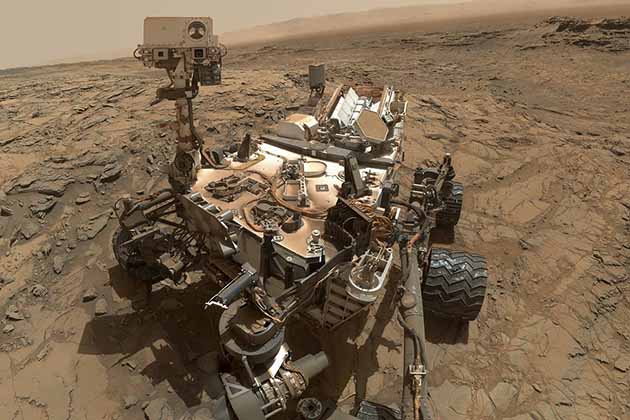
The Curiosity rover took a selfie at the “Big Sky” drilling site.
Rona
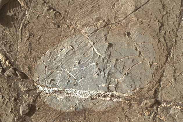
This photo features a mienral vein on the rock Rona, which is near the southern, upper edge of Vera Rubin Ridge on Mount Sharp.
M9a in Murray Buttes

The top of the butte here stands about 16 feet above the rover and about 82 feet east-southeast of the rover.
Mount Sharp
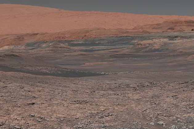
This shot of Mount Sharp was captured by the Mars Curiosity rover.
Point Lake Outcrop
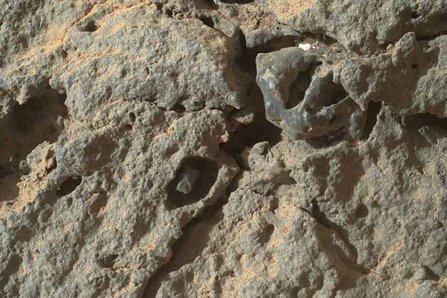
This shot was taken by the Mars Curiosity rover just four inches from the surface of Point Lake outcrop.
Curiosity's Wheels
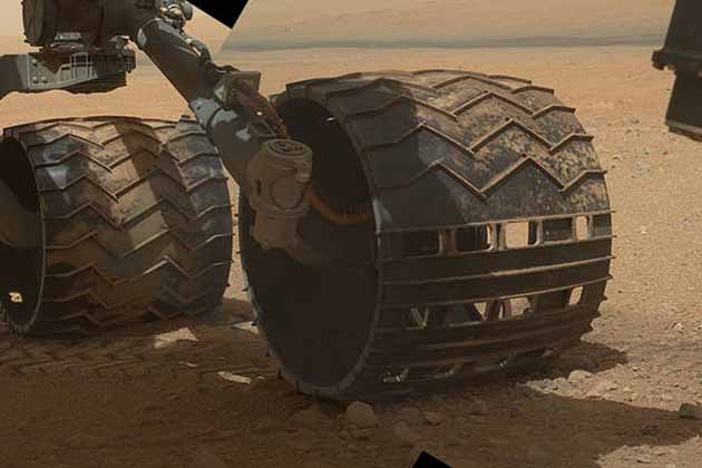
Here, you can see the three left wheels of Mars Curiosity rover. You can also see Mount Sharp in the distance!
Murray Buttes Hills
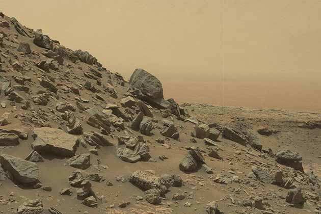
Here, the Mars Curiosity rover captured a sloping hillside within the “Murray Buttes” region Mount Sharp.
Whale Rock's Cross-Bedding
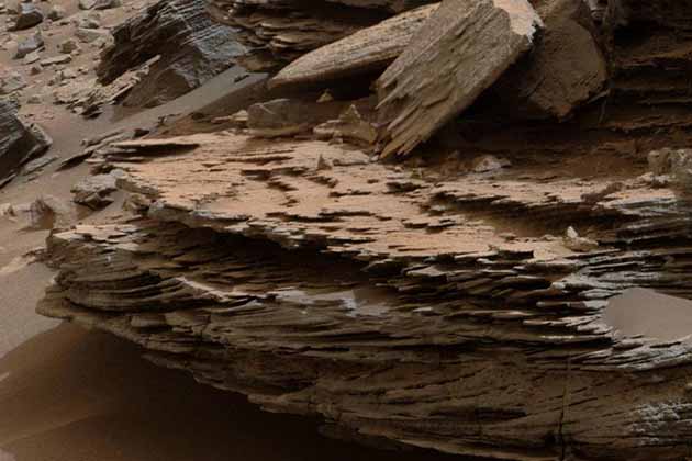
Whale Rock is at the base of Mount Sharp. This photo, taken by Mars Curiosity Rover, shows the cross-bedding that’s caused by water passing over a loose bed of sediment. It was taken on November 2, 2014.
Testing Curiosity's Arm
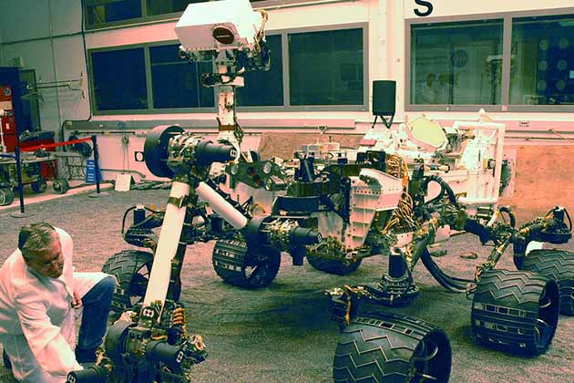
In this shot, taken by the test rover Vehicle System Test Bed (VSTB), shows the testing of Mars Curiosity rover’s arm movement precision.
Hinners Point
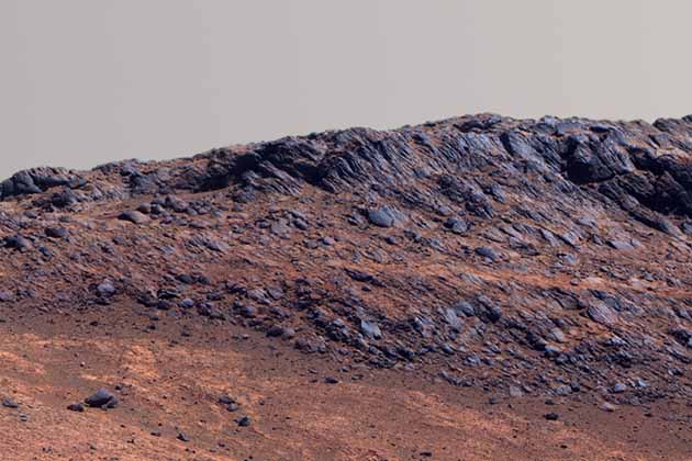
This shot combines six frames, taken by Mars Exploration rover, and was taken on August 14, 2015. Hinners Point is at the northern edge of Marathon Valley.
Perseverance Valley
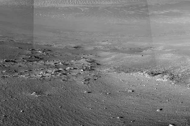
Mars Exploration Rover Opportunity used its Navigation Camera (Navcam) to take the component images of Perseverance Valley on January 4, 2018.
Strata on Mount Sharp

This view of the “Kimberly” formation was taken by Mars Curiosity rover.
Color Variations on Mount Sharp
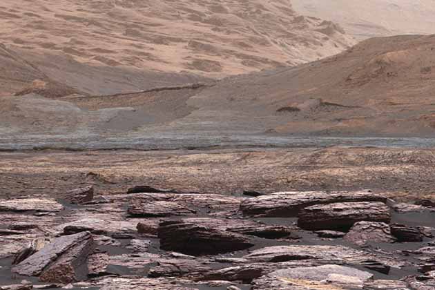
This gorgeous scenery was taken in late 2016 by Mars Curiosity rover. The visible higher layers are future destinations for the rover’s mission.
Drilling at Cumberland
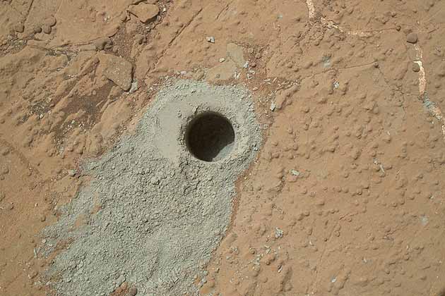
Mars Curiosity rover drilled into rock target Cumberland to collect a sample of the rock on May 19, 2013.
Martian Lakebed
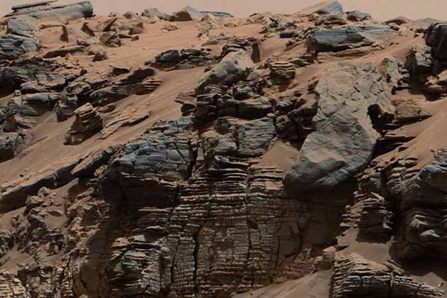
Here, you can see a pattern typical of a lake-floor sedimentary deposit, taken by Mars Curiosity rover.
Windjana
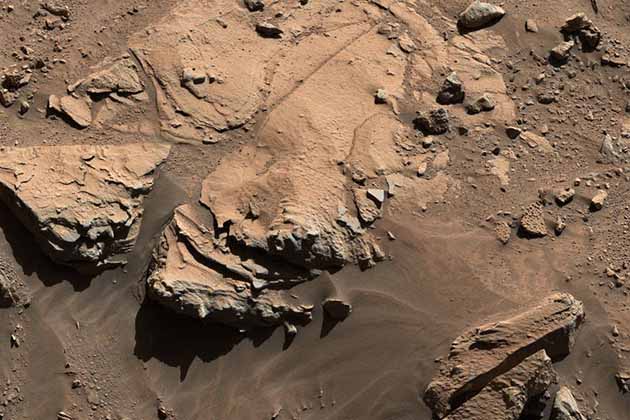
Here, the Mars Curiosity rover captures a sandstone target known as Windjana.
Opportunity Legacy Pan
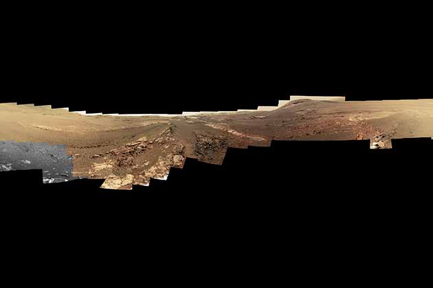
From NASA.goc: “This 360-degree panorama is composed of 354 images taken by the Opportunity rover’s Panoramic Camera (Pancam) from May 13 through June 10, 2018. This is the last panorama Opportunity acquired before the solar-powered rover succumbed to a global Martian dust storm on the same June 10.”
Rock Comparison
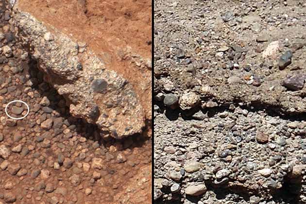
These images, taken by Mars Curiosity rover, compares the Link outcrop of rocks on Mars (left) with similar rocks seen on Earth (right).The image of Link, obtained by NASA’s Curiosity rover,
Ancient Drying in Martian Rock?
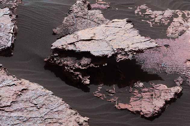
Here, you can see possible signs of ancient drying in Martian rock. It may have originated as cracks in drying mud more than 3 billion years ago.
Mount Sharpe's Buttes and Layers
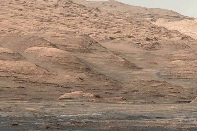
This shot, taken by the Curiosity rover, shows buttes and layers on the lower flank of Mount Sharp.
Martian Rock Harrison
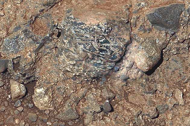
This view of a Martian rock target merges images from two cameras from the Curiosity rover to provide both color and microscopic detail.
Martian Layers
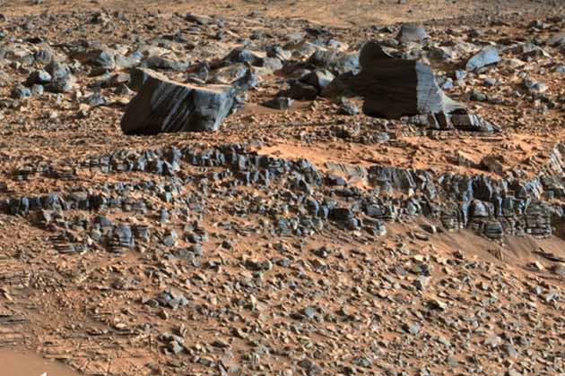
This photo, taken by the Curiosity rover, shows strata exposed along the margins of the valleys in the “Pahrump Hills” region.
Weather Station Tools
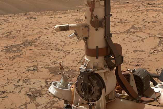
The Rover Environmental Monitoring Station (REMS) on the Curiosity rover includes temperature and humidity sensors, mounted on the its mast.
Ireson Hill
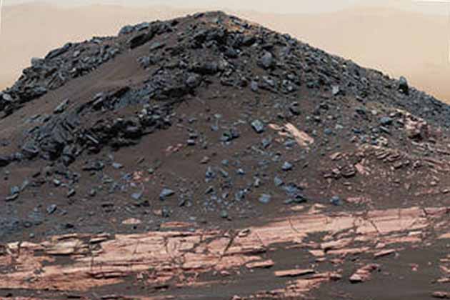
This view from the Curiosity rover’s Mastcam shows “Ireson Hill,” which rises about 16 feet above layered outcrop material on lower Mount Sharp.
Mars Ripple
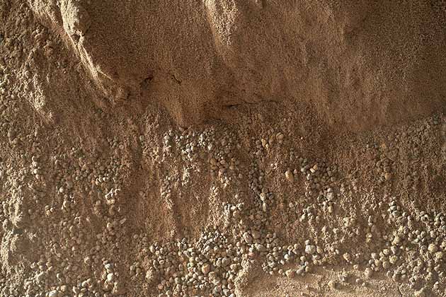
According to NASA.gov, this image shows “the wall of a scuffmark Curiosity made in a windblown ripple of Martian sand with its wheel. The upper half of the image shows a small portion of the side wall of the scuff and a little bit of the floor of the scuff (bottom of this image).”
Selfie at Murray Buttes
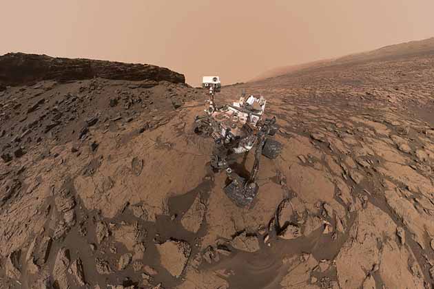
The Curiosity rover took this self-portrait at the “Quela” drilling location in the “Murray Buttes” area on lower Mount Sharp.